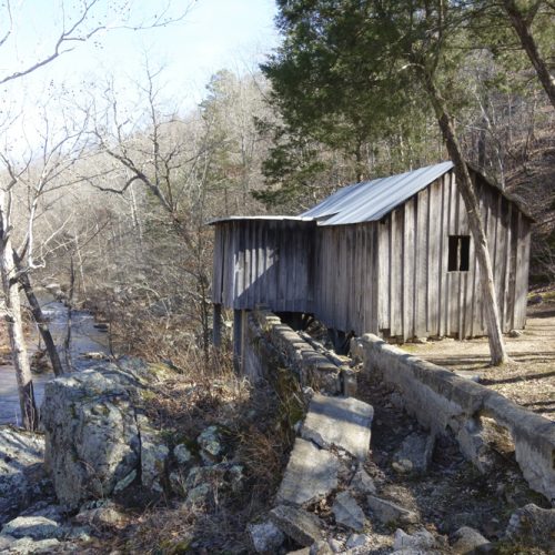
Madison County in Iowa has its covered bridges, made famous by James Wallers’ novel, “The Bridges of Madison County.” Miller County in Missouri lays claim to six swinging bridges. According to the U.S. Army Corps of Engineers, Missouri has only12 swinging suspension bridges left.
In Miller County, of the existing six bridges, four lie within a few miles of Missouri Highway 42 near the Lake of the Ozarks. A trip to any of these bridges makes an entertaining and educational side road excursion while driving to or from the Lake.
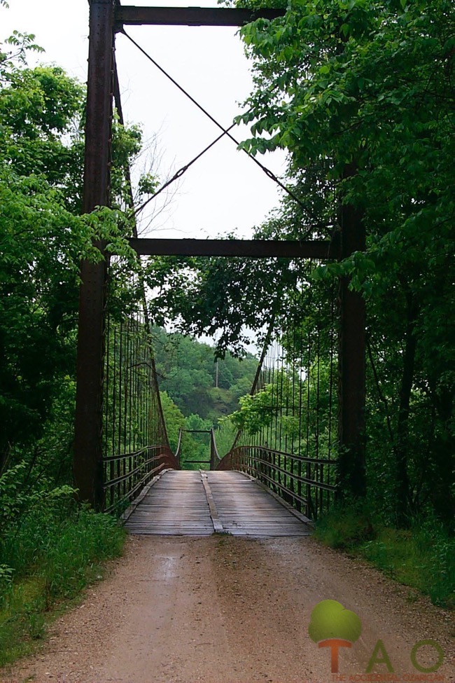
Visitors may walk or drive (depending on the vehicle’s weight) across each bridge. The load limits range from two to fourteen tons. At some of the bridge sites, gravel bars, campsites and fishing opportunities await those who seek out these gentle swaying structures from the 1920s-30s.
Just as the bridges in Iowa had a story, the bridges in Missouri have a rich history, complete with adventure and tragedy.
Built by Joseph Dice, of Warsaw, Mo. – in the days when string and mules were commonly used to plan and execute construction – these single-lane suspension bridges have undergone very little change, other than routine maintenance and repair.
According to Peggy Smith Hake, Miller County historian and genealogist, Dice became an apprentice to a master bridge builder in the Warsaw area named Dr. D.M. Eddy, a physician who also designed and built bridges. Eddy built the first swinging bridge in the Lake area in 1895, and Dice was his foreman on this project.
Dice went on to build 40 bridges of varying lengths in central Missouri, each measuring12-14 feet wide. He never drew plans, preferring to use a ball of twine to figure curvatures and spans. Men on horseback and in boats pulled the wires used to build the bridge cables across the creeks, and men with mules hauled cement, river gravel, and timbers to the sites.
Hake writes, “We are told that Mr. Dice could tell by the ‘feel’ of the wire if the tension was right.” When the state transportation department started requiring blueprints for bridges, Dice retired.
The Swinging Bridges of Miller County
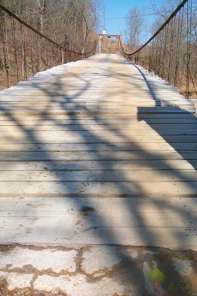
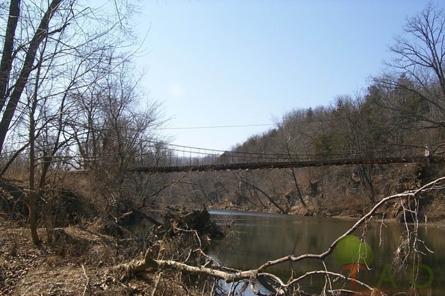
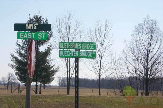
Two of the bridges cross the Big Tavern Creek near St. Anthony. The bridges are easy to find because they have namesake roads. The Kliethermes Bridge, built in the late 1920s and located about three miles to the west of the town, measures 304 feet long.
Wilson Camp Public Fishing Access, maintained by the Missouri Department of Conservation, is located on the western side of the bridge. Visitors may fish or launch a canoe from a large parking area at the foot of the bridge.
The second bridge near St. Anthony lies 2 ½ miles south. It is called the Buechter (pronounced “Booster”) Bridge and is 128 feet long. Private property lines both sides of the bridge, but there is a place to pull off and park on the north side of the bridge.
A tragedy occurred on this bridge in August 2000, when a recently-employed Miller County transportation worker driving a dump truck attempted to cross the bridge. Carrying a load of gravel that exceeded the bridge load limit, the driver’s truck crashed through the bridge, pinning him and drowning him in the creek.
As a result of the accident, both bridges near St. Anthony have been refurbished with new planks and reinforced with new cables.
The second set of swinging bridges is located off Highway 42, near Brumley. Referred to as either the “Twin Bridges of Brumley” or the “swingers,” these bridge sites belong to the Lake of the Ozarks State Park. In 1931, during construction of Bagnell Dam, Union Electric built the bridges to replace former low-water bridges that were covered with water.
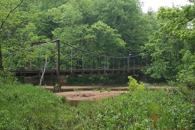
The first bridge of the set, The Mill Creek Bridge, measures 100 feet and crosses Miller Creek. New cables and corrugated steel planks reinforce the old bridge.
Beyond the Mill Creek Bridge lies the “Mother” of all the Miller County bridges – the Auglaize Bridge. It measures 400 feet long and boasts a weight allowance of 15 tons. Although grand in size, weathered, hole-ridden boards line the deck of this bridge, and gnarled cables groan and twist like old joints when in motion.
Visitors may picnic on gravel bars at either of the Brumley bridges, and fires are allowed in designated areas. Overnight tenting is also allowed –with payment on the honor system. Restrooms are provided. In-season fishing and frogging can be productive at both bridge sites, especially after heavy rains.
History may be seen and felt in these old bridges, and they afford opportunities not only to discuss the past, but also the principles of mathematics and physics. Or, if thinking is not in the plan for the day, just spending time near the old bridges while enjoying a picnic or casting a line may prove therapeutic.
To get to the bridges near St. Anthony, take Highway A north from Highway 42, a few miles east of Iberia. Turn west into St. Anthony and follow the appropriately-named roads.
The “Twin Bridges of Brumley” can be found on Swinging Bridges Road, off Highway 42 on the left side as you leave Brumley heading toward the Lake of the Ozarks.
Before crossing any of these bridges, please note the specified weight limits. SUV’s are often too heavy to cross the bridges.
For more information about the Brumley bridges, call the Lake of the Ozarks State Park office at 573-348-2694. Reservations for camping may be made at www.mostateparks.com.
First published in 2003 (St. Louis Post Dispatch)

